China conducts seabed survey east of Taiwan amid rising maritime tensions
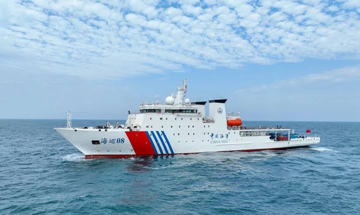
NEW DELHI: China conducted a comprehensive marine geophysical survey in waters east of Taiwan from August 10 to 31, in a move that comes amid heightened tensions between Beijing and Taipei. China's Ministry of Natural Resources said the survey was aimed at improving understanding of seabed geology and supporting territorial planning, natural-resource management and the development of a unified spatial-planning database.
The survey was carried out by the ministry's Second Institute of Oceanography and used a range of technologies, including multibeam sonar, multichannel seismic exploration, ocean-bottom seismic observations, and gravity and magnetic measurements. The operation collected data on seabed topography, sedimentary layers, deep geological structures and other geophysical characteristics.
According to Chinese authorities, the information gathered will support scientific research into seabed sediments, tectonic structures, deep-crustal architecture and geological evolution. Beijing also said the data would provide a scientific basis for the comprehensive management of waters it considers under its jurisdiction east of Taiwan.
The activity has nevertheless attracted attention in Taiwan, where authorities view China's growing maritime presence around the island with concern. Taiwan's coast guard said on August 21 that it had warned off and shadowed a Chinese research vessel operating in sensitive waters near Taiwan. Taipei has characterised such activities as maritime provocation and rejects Beijing's sovereignty claims over Taiwan and surrounding waters.
The seabed survey also coincides with continued Chinese coast guard activity east of Taiwan. China's coast guard said it conducted a routine law-enforcement patrol in the area on September 3, marking the third such patrol since June. The simultaneous presence of research vessels and coast guard ships has added to scrutiny of Beijing's maritime activities around the island.
China claims Taiwan as part of its territory and has repeatedly asserted jurisdiction over waters surrounding the island. Taiwan's government rejects those claims and maintains that Beijing has no authority over Taiwan's territorial waters. The dispute has intensified in recent years as China has increased military, coast guard and other maritime activities around Taiwan.
The latest survey is therefore significant not only for its stated scientific and resource-management objectives but also because detailed seabed mapping can have broader strategic importance. Research into underwater terrain and geological conditions can improve understanding of maritime environments, although China's Ministry of Natural Resources has publicly described this particular operation in terms of scientific research, territorial planning and marine management.
The development comes as Taiwan continues to monitor what it describes as increasingly assertive Chinese activity around the island. Taipei's latest defence assessment has warned that Beijing is strengthening its ability to control air and sea routes around Taiwan, while Chinese maritime patrols and military operations continue to contribute to tensions in the Taiwan Strait and surrounding waters.