Suhora Technologies launches open satellite platform to support Nepal flood response
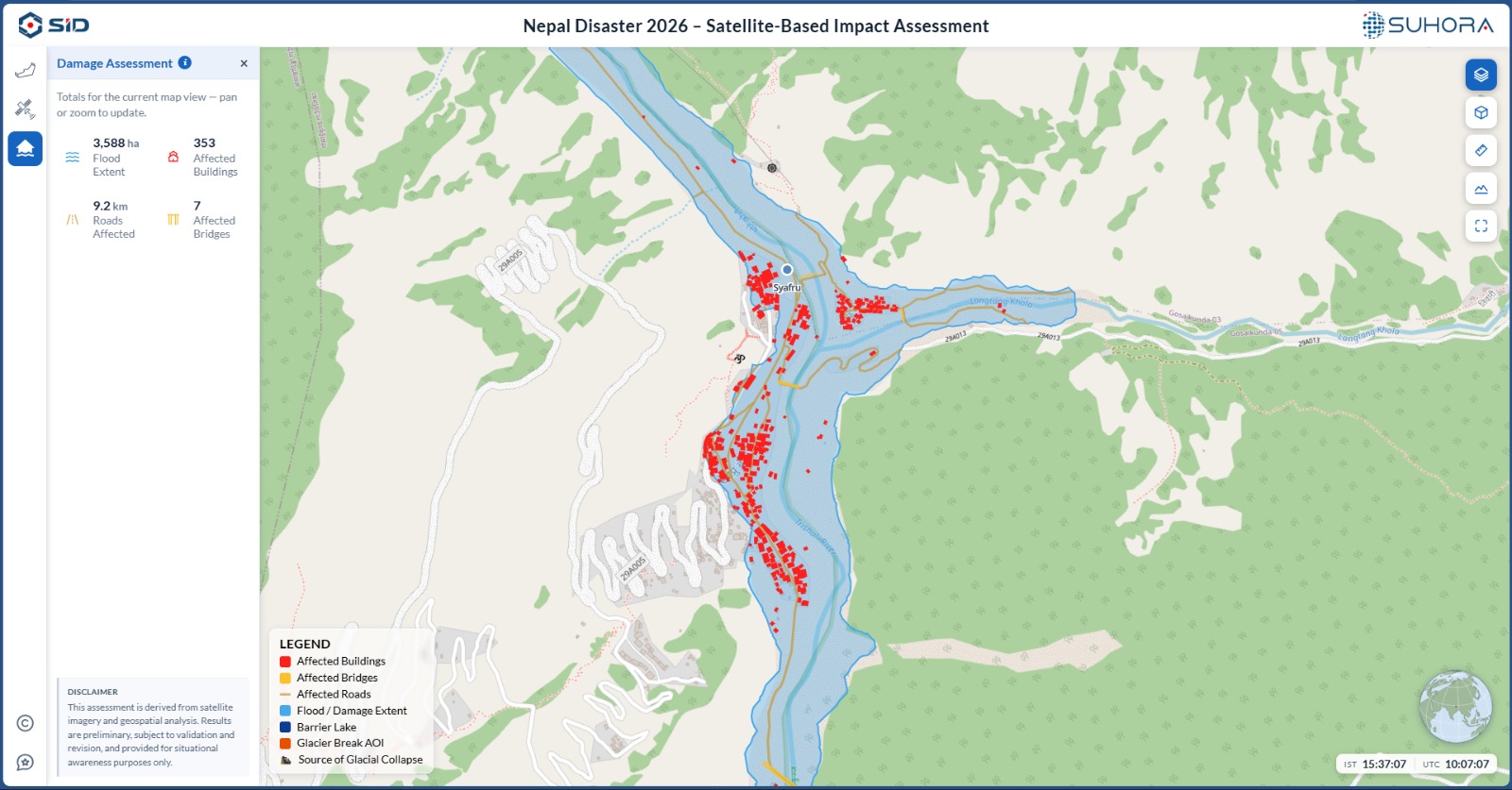
NEW DELHI: Indian space-data analytics and intelligence firm Suhora Technologies has launched a free, web-based disaster assessment platform to support rescue and relief efforts in flood-affected areas of Nepal.
The platform brings together satellite imagery, open-source datasets and Suhora’s analysis to provide real-time insights into the scale of destruction. It currently covers major affected areas including Betrawati, Bidur, Devi Ghat, Mailung, Rasuwa, Syafru, Taruka, Timure, Trishuli Solar Plant and Trishuli Bazar.
The tool provides data and visualisations on affected buildings, bridges and roads, flood and damage extent, barrier lakes and the source of glacial collapse. It is designed for use by relief agencies, researchers, media organisations and affected communities.
The platform offers three key features: Bird’s-Eye View, providing an overview of disaster-affected areas; Satellite Image Comparison, enabling users to compare pre- and post-disaster imagery; and Damage Assessment, offering statistics and visualisations of damage to buildings, bridges and infrastructure.
The satellite imagery includes data from ISRO, Vantor, PlanetScope, Sentinel and Landsat, enabling users to assess changes across affected areas.
Krishanu Acharya, Founder and CEO of Suhora Technologies, said satellite data has become an important source of information where ground access remains disrupted. He said the company aims to make satellite intelligence openly accessible so that relief agencies, researchers and communities can better understand the extent of the disaster and support targeted relief efforts.
The launch builds on Suhora’s earlier satellite analysis of the Betrawati region, which identified extensive debris covering the commercial area and a newly formed glacial lake of approximately 20.25 hectares at the source of the avalanche, raising concerns over potential downstream flooding.
The platform is available at nepalflood.suhora.com and includes a feedback mechanism to help improve the tool as relief and recovery operations continue.